Disruption of navigation systems in the Gulf following US-Israeli strikes on Iran
Within 24 hours of the first US-Israeli strikes on Iran, ships in the region’s waters experienced significant navigation disruptions, incorrectly indicating positions at airports, nuclear power plants, and on Iranian land, reports BritPanorama.
The confusion stemmed from extensive jamming and spoofing of global positioning satellite systems. These tactics, employed by various military groups in conflict zones, involve broadcasting strong radio signals on frequencies used by navigation tools. Jamming disrupts satellite-based positioning, while spoofing misleads systems about their actual locations.
Although commercial vessels are not direct targets, the electronic interference affected more than 1,100 commercial ships operating in the UAE, Qatari, Omani, and Iranian waters around February 28, according to Windward, a maritime intelligence firm.
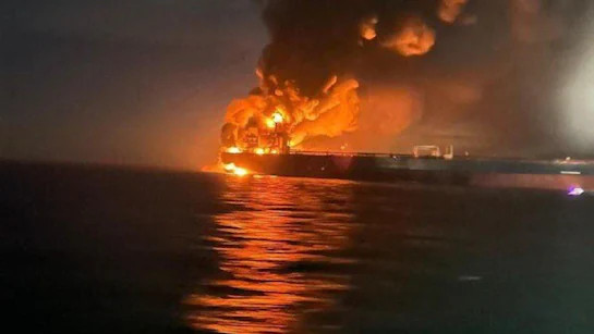
As navigation through the Strait of Hormuz, which carries about 20% of the world’s oil and gas exports, is vital, reports indicate that marine traffic has nearly halted due to these disruptions. Attacks on vessels and withdrawal of maritime insurance have compounded the situation.
“What we’re seeing in the Middle East Gulf at the moment is extremely dangerous for maritime navigation,” said Michelle Wiese Bockmann, a senior maritime intelligence analyst at Windward. The interference has compelled tankers to reverse course or obscure their identities by ceasing to transmit signals from their Automatic Identification System (AIS), which broadcasts vital information such as position and speed.
“You don’t know where ships are. The whole point of AIS is collision avoidance,” Bockmann remarked. “When you have vessels thrown onto land or thousands of nautical miles across the sea, it is deeply troubling and dangerous.”
In the first 24 hours following the inception of the conflict, Windward identified 21 new areas of AIS jamming, a number that escalated to 38 just one day later. Lloyd’s List Intelligence documented 1,735 GPS interference events affecting 655 vessels between the war’s onset and March 3. The rate of daily incidents surged from 350 to 672 by March 2, indicating a troubling trend.
As this tactic becomes more prevalent, experts are concerned that the implications could extend far beyond immediate conflict zones.
Endemic problem
The jamming and spoofing of signals from global navigation satellite systems (GNSS) is not a new issue. These challenges have plagued shipping and aviation since the Russian invasion of Ukraine in 2022, which heavily utilized drones in combat.
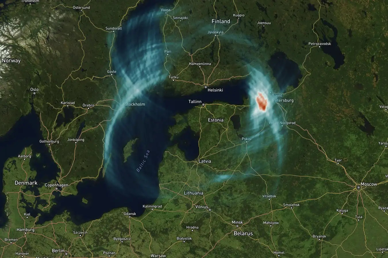
Bockmann classified the disruption as “endemic” in certain areas near conflict, referring to regions like the Baltic Sea, Black Sea, and parts of the Middle East, where “grey zone aggression,” or non-openly hostile military activity, is prevalent.
Ramsey Faragher, director and CEO of the Royal Institute of Navigation in London, affirmed that the jamming and spoofing of navigational signals serves as a straightforward protective measure against drone strikes. However, the resulting electronic fog complicates navigation for commercial vessels not involved in the hostilities.
“We’ve known for decades that signals civilians rely on from space are vulnerable to jamming and spoofing. It’s just that it’s never been this serious a problem before,” Faragher stated. He noted the growing integration of GPS-guided drones in contemporary conflicts since their increased deployment compared to two decades ago.
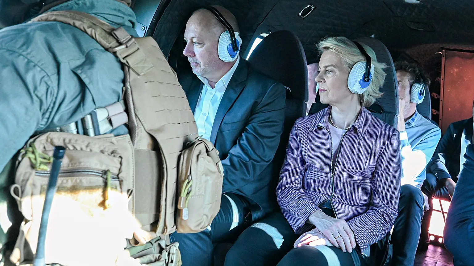
In June 2025, electronic interference with navigation was cited as a contributing factor in the collision between two oil tankers off the UAE coast. The operator of the Front Eagle labelled it a “navigational incident.” Interference also poses risks to aircraft operating in affected regions. In September, a plane carrying European Commission President Ursula von der Leyen was affected by GPS jamming while attempting to land in Bulgaria, requiring pilots to rely on traditional paper maps, though it remains unclear if the jam was intentional.
According to the International Air Transport Association, incidents of global positioning system signal loss affecting aircraft surged by 220% between 2021 and 2024, prompting calls for the aviation industry to bolster defenses against such threats.
“Cockpits are seeing their navigation displays literally drift away from reality,” remarked a commercial pilot, who requested anonymity. He detailed experiences of misleading map shifts and false altitude readings that necessitate manual pilot intervention, especially during long-haul flights.
Why GPS is so vulnerable
The vulnerability of GPS arises from its extensive usage relative to other global navigation systems like Europe’s Galileo, China’s BeiDou, and Russia’s GLONASS. Publicly accessible GNSS signals lack security features, a reality that became more evident with GPS signals—used widely because they weaken as they travel. However, since last year, Galileo has introduced a feature allowing users to authenticate their signals for tampering.
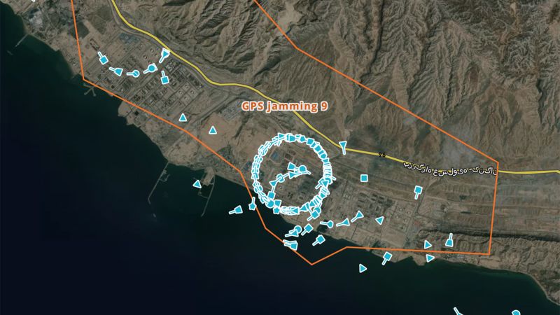
Jamming incidents are readily identifiable on AIS tracking maps often showing affected vessels moving in predictable patterns or appearing fixed on land points, typically airports or bases linked to the spoofing source.
Manipulation of GPS can also be exploited for illicit purposes, such as evading sanctions or misdirecting vessels for theft or ambush.
A real-world test
Modern automated ships may be especially susceptible to these interferences, as many crew members lack familiarity with traditional navigation techniques. Navigator reliance on alternative navigational tools, like radar and celestial navigation, is becoming a pressing necessity.
The implications of GPS interference extend beyond immediate navigation issues. Compliance challenges arise for shipping companies, especially when signals direct vessels towards sanctioned territories, leading to heightened scrutiny from banks and insurers.
Faragher expressed concerns regarding potential rescues becoming complicated due to incorrect emergency broadcast positions caused by jamming signals. The ongoing conflict represents a significant challenge for maritime navigation where systems must adapt swiftly to unreliable satellite signals.
Alternative technologies and systems designed to safeguard against jamming are in development, but upgrading existing equipment requires significant time and investment.
The capabilities of GNSS are remarkable but increasingly under threat, demanding urgent reassessment of navigational dependencies in modern maritime operations.